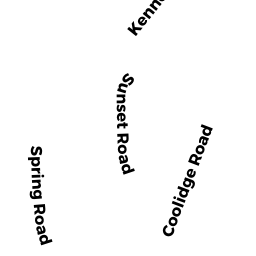
28 SUNSET RD
Owner Information
BARILE, FRANCIS J. &
28 SUNSET RD
NAHANT, MA 01908


Property Details
28 SUNSET RD is classified as a Single Family Residential (Colonial).
The primary structure on this property was built in 1997. There are 2,888ft2 of built area within this property. There is 2,888ft2 of residential/living space within this property. This property is listed as having 8 rooms.
28 SUNSET RD is valued at $781,800. The land is valued at $325,600 and the structures are valued at $456,200.
This property is in Zone R2. Confirm with local Zoning Board authorities to ensure there are no overlays or other easements on this property.
28 SUNSET RD was last sold on Thursday, January 27, 1994 for $75,000.
Assessment data from fiscal year 2022.
Flood Data
According to the FEMA National Flood Hazard Layer, this property does not appear to be in a flood zone. It may also be in an area not yet reviewed. Nonetheless, confirm this information prior to taking any action.
To view the flood hazards around this property, create a FEMA "Firmette" Map of the area around 28 SUNSET RD.
Broadband Internet Providers
| Provider | Type | Bandwidth (mbps) | |
|---|---|---|---|
| Comcast | Cable | 1000 | 35 |
| HughesNet | Satellite | 25 | 3 |
| VSAT Systems, LLC. | Satellite | 2 | 1 |
| Verizon New England Inc. | Fiber | 940 | 880 |
| Verizon New England Inc. | DSL | 5 | 0 |
| Viasat Inc | Satellite | 100 | 3 |
| T-Mobile | Fixed Wireless | 25 | 3 |
| GCI Communication Corp. | Satellite | 0 | 0 |
Broadband service provider data from December 2020.
Adjacent Properties
- 42 SPRING RD
Single Family Residential owned by ANDERSON, KELSEY - 40 SPRING RD
Single Family Residential owned by DESMOND, DAVID F & - 20 SPRING RD
Single Family Residential owned by MOLETI, FRANCES A; LIFE TEN - 26 SUNSET RD
Single Family Residential owned by ANDERSON, BETH ELAINE & - 38 SPRING RD
Single Family Residential owned by ABRAHAM, YVONNE - 22 SPRING RD
Single Family Residential owned by BARILE, FRANCIS J &